Search, Rescue and ISR

The increasing number of migration flows, the illegal trafficking of humans and narcotics, and the need to protect the environment are challenges that governments and relief organizations are facing. Search and rescue, border control, and ISR (Intelligence, Surveillance and Reconnaissance) activities have become increasingly important to ensure the safety of people and the environment. These activities are often complex and demanding and require the use of cutting-edge technology.

Q.System
Integrated Solution for SAR and ISR

Q.System is an innovative solution that combines cutting-edge multi-spectral imaging technologies with artificial intelligence algorithm and data sharing systems to speed up search and rescue activities and coordinate interventions.

Q.FLY devices, installed on helicopter, drones, or aircrafts, exploit GPU-based edge computing systems and sophisticated Machine Learning and Artificial Intelligence algorithms to detect and geolocate people or objects, even in conditions of poor visibility or particular morphological configurations of the territory.

Furthermore, Q.FLY devices differ from conventional technologies used for SAR and Mission Intelligence operations due to their ability to aggregate information from different systems, such as cellular receivers, localization data and other surveillance equipment.

The data acquired by Q.FLU sensor is transmitted in real time to operations rooms and data processing centres, allowing ground operators to coordinate operations and activate the necessary emergency procedures quickly and effectively.

ADVANTAGES

Higher accuracy:

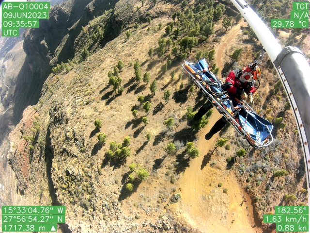
integrating information communicated by third-party systems with imaging algorithms allows you to detect and geolocate targets with higher accuracy and reliability compared to traditional Mission Intelligence and Surveillance technologies.

Higher efficiency:

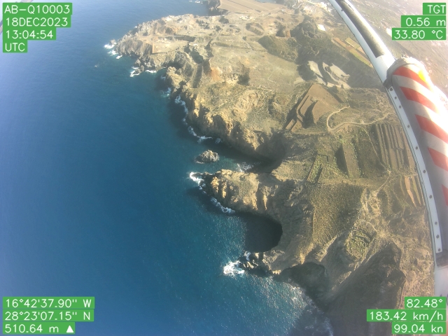
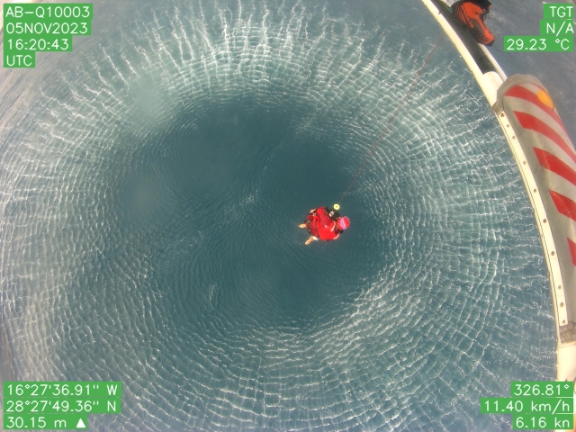
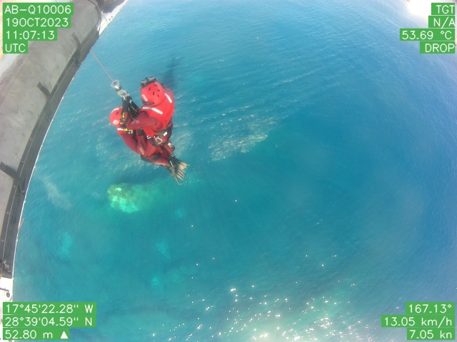
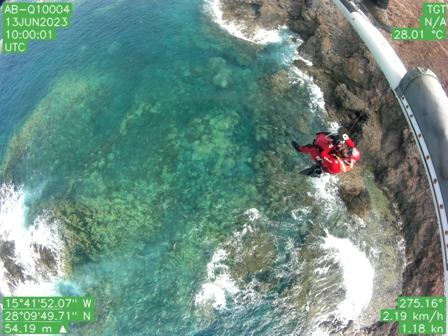
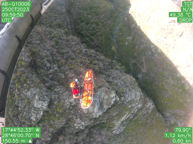
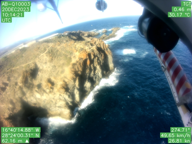
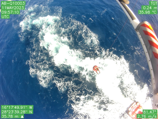
360° imaging system that allows the pilot to stabilize the helicopter without having blind spots, increasing the safety of rescue operations. This reduces the risk of accidents for rescue workers.

Data sharing:

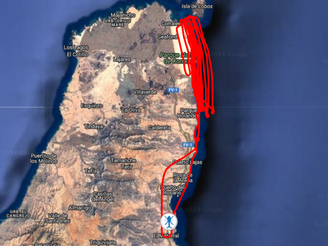
real-time sharing of aerial data to control centres allows for better coordination in Mission Intelligence operations.

Data digitization:

the acquired data is automatically digitized, facilitating information analysis and intelligence activities.

Security:

Remote inspection enables us to reduce the risk of accidents for operators.

ACTIVITIES

  • Search and Rescue (SAR) at sea and in the mountains;
  • Coast and border control to combat illegal immigration;
  • Control of illegal drug trafficking;
  • ISR (Intelligence, Surveillance and Reconnaissance) activity;
  • Detection and counting of people in protected natural parks;
  • Vessel detection in marine protected areas;